
Starved Rock, Illinois
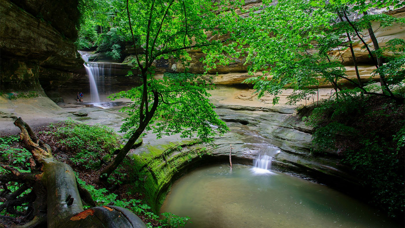
With its deep canyons and rushing waterfalls, Starved Rock State Park is an anomaly in the flat Midwestern landscape. That – along with its proximity to Chicago and rich history – has made it an extremely popular destination for generations of Chicagoans.
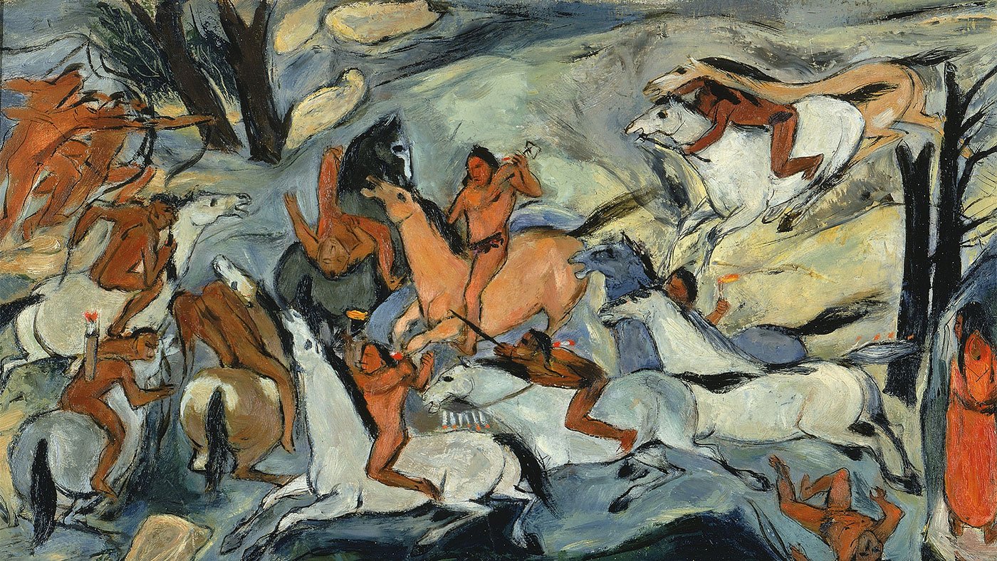
The park took its rather grim name from an eighteenth-century legend of revenge. According to the story, a member of the Illiniwek tribe killed the great Ottawa leader Pontiac in 1769. Ottawa warriors launched an all-out war to avenge Pontiac’s death, and were joined by allied tribes, including the Potawatomi. After several battles, the larger allied forces chased one of the last bands of Illiniwek through what is now Starved Rock State Park. According to the legend, those Illiniwek survivors took refuge atop a 125-foot sandstone butte and were surrounded. The proud Illiniwek stayed there, preferring death by starvation to surrender. When the Ottawa and their allies finally scaled the rocks, they killed off the few remaining survivors. Days later, traders en route to Canada, wondering why swarms of buzzards had gathered there, scaled the butte and bore witness to the carnage.
Although it is difficult to know whether the legend of Starved Rock is true, archeologists have documented several different Native American groups that inhabited this area for more than 10,000 years before the arrival of Europeans.
The first non-native people to pass through this area were Father Jacques Marquette and fur trader Louis Joliet, who traveled up the Illinois River in 1673. Soon after, the French established Fort St. Louis at the summit of Starved Rock to serve as headquarters for French-Indian trade.
In 1911, Starved Rock became Illinois’s first state park after the state purchased the land from Chicago businessman Ferdinand Walther, who had built a hotel, cottages, and a private park on the property.
Explore the Rocks
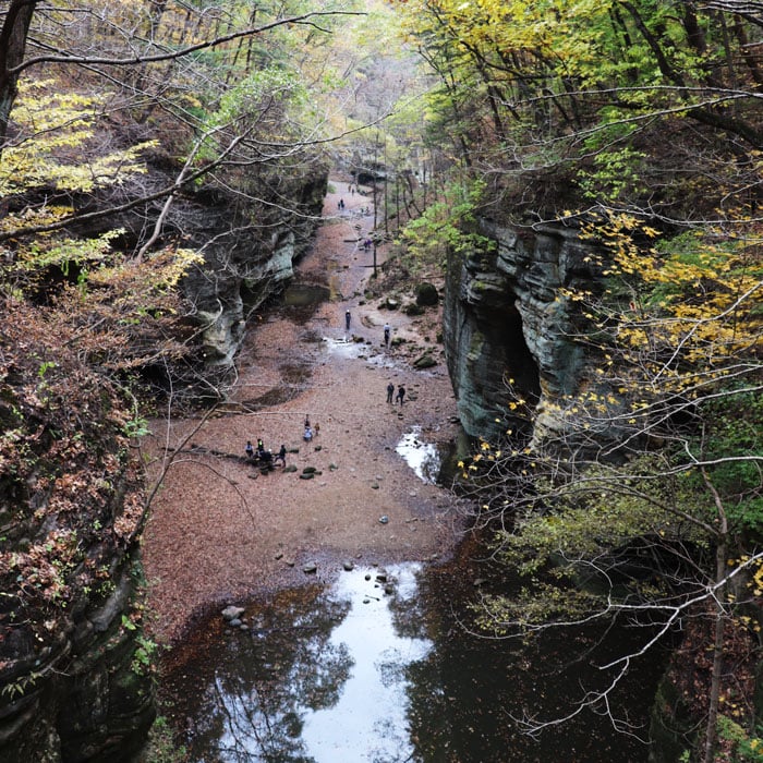
At the Starved Rock State Park Visitors Center, you can learn about the history of the place, the plants and wildlife that call it home, and, of course, its defining characteristic: those rocks. The massive sandstone formations here were carved out thousands of years ago by melting glaciers whose water raced across Illinois and then headed south towards the Gulf of Mexico. In the spring, waterfalls retrace that watery path, rushing into most of the 18 canyons found in the park. In the winter, many of them transform into icefalls.
The canyons can be reached only on foot, and the most reliable spring waterfalls and winter icefalls are to be found in the St. Louis, French, Wildcat, Tonty, Ottawa, and Kaskaskia Canyons. The hiking trails further from the lodge tend to be less crowded, although the paths near the lodge have certain advantages, including sweeping views of the river.
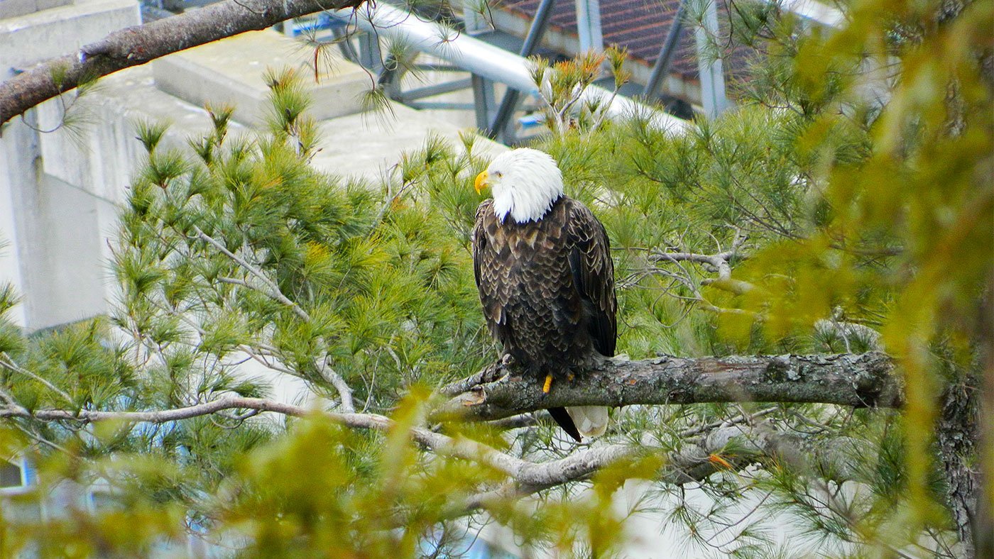
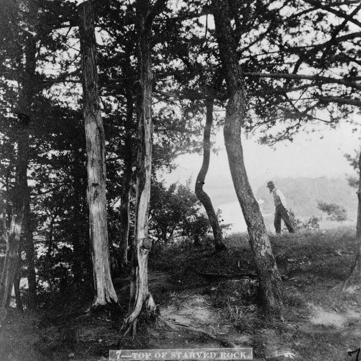
In the winter months, lookout points at Eagle Cliff, Lover’s Leap, and the top of Starved Rock also offer views of bald eagles, whose populations increase dramatically in the winter as they migrate south from Wisconsin and Minnesota. Several families of eagles regularly make their winter nests on Plum and Leopold Islands, where they can easily catch fish near the dam. (Binoculars can be rented at the Visitor’s Center.) While many eagles can typically be seen from Starved Rock, visitors can get closer at the Illinois Waterway Visitor Center.
If you do visit in the winter and there is snow on the ground, Matthiessen State Park in nearby Ogelsby offers cross-country ski rentals. In the warmer months, when Starved Rock gets crowded, Matthiessen and the nearby Buffalo Rock State Park also provide hikers with off-the-beaten-path alternatives.
And bike riders flock to the I&M Canal State Trail, where a continuous, 15-mile stretch of the old canal towpath has been either paved or covered with crushed limestone. The trail is also a history lesson on the canal that built Chicago and northern Illinois. In Ottawa, visitors can see the last remaining toll house along the I&M canal. And at the end of the ride in LaSalle, visitors can see an old canal lock and even go for a ride on a replica of a mule-pulled canal boat.
Bikes – and boats – can also be rented in Ottawa. For those looking for a more active adventure, river rafting is becoming increasingly popular nearby on the Vermillion River, also popular for fishing.
Sample the Local Fare
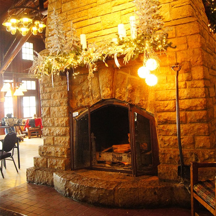
After a long day outdoors, Starved Rock and the surrounding river towns offer a number of places to rest and refuel. The old Starved Rock Lodge and Conference Center, built by the Civilian Conservation Corps in the 1930s, is a favorite. In the winter, visitors here gather around the large stone fireplace in the Great Hall. And in the summer, the veranda is a popular place to watch the sun set behind the trees.
The quaint towns nearby also have several dining options. Among them are Duffy’s Tavern, an Irish pub in North Utica, and The Lone Buffalo in Ottawa. The latter is part of the Tangled Roots Brewing Company, a local brewery firmly planted in the surrounding region. Not only does the brewery source many of its ingredients locally, several of its beers – including the Sieur de La Salle Lager and Vermilion River Weiss – celebrate local landmarks and legends.
The appreciation for history is also visible throughout Ottawa in a series of murals which tell the stories of the people and events that have shaped this part of Illinois – from those earliest Native American residents to a Civil War general who hailed from Ottawa to hometown heroes of today.